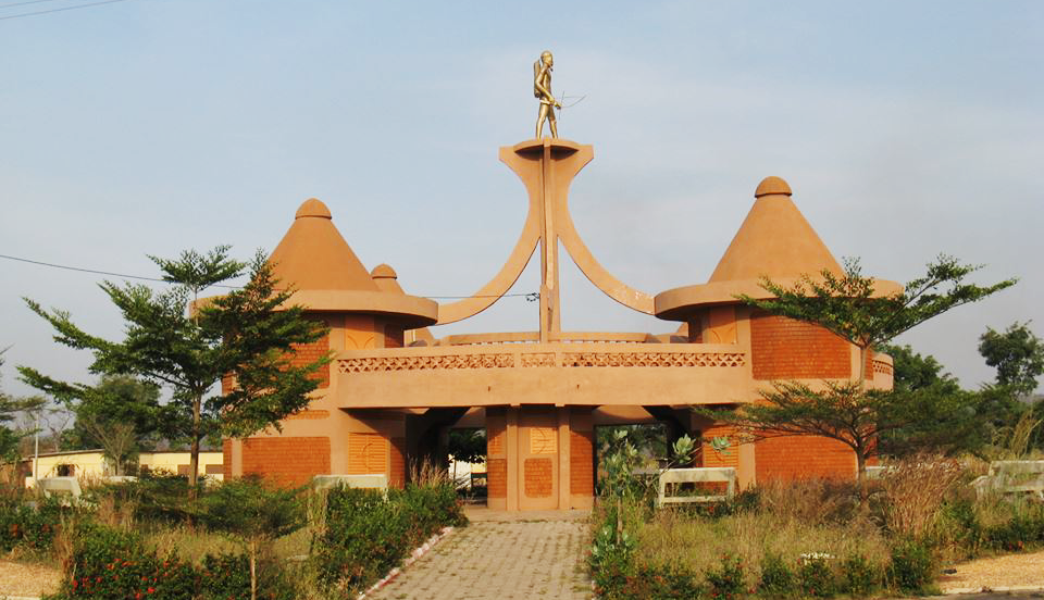
Savé
Savé, chief town of the Collines in Benin, stands out for its granite rock domes, Shabè Yoruba identity and regional market. A concrete stop on the Cotonou-Parakou road.
Savé is a city in central Benin, capital of the Collines department, perched on a rocky massif that rises above the surrounding plain. A historic crossroads between the north and south of the country, it is known for its granite inselbergs, its predominantly Yoruba population, and its role as a stopover town on the national highway. The market and the hills surrounding the city make it a concrete halt for those crossing Benin.
What to see there
The most visible feature of Savé is its landscape: granite rock domes (inselbergs) emerge from savanna woodland vegetation. The city itself is animated by a regional market where Yoruba, Fulani and other communities from the Collines converge. Local architecture blends banco constructions and administrative buildings inherited from the colonial period.
History and context
Savé is historically linked to the Yoruba kingdom of Shabe (or Shabè), one of the Yoruba kingdoms established in present-day Benin. This kingdom maintained distinct political and cultural structures until French colonization. The city retains a marked Yoruba identity, visible in language, religious practices (vodoun and Islam coexist) and traditional ceremonies linked to Shabè royalty.
Highlights of a visit
The inselbergs
The rock formations surrounding Savé offer views over the Collines plain. Some are accessible on foot from the city. The rupicole vegetation that colonizes the fissures of the granite is characteristic of this type of Sahelo-Sudanian landscape.
Savé Market
The regional market brings together vendors from throughout the Collines department and beyond. Agricultural products, fabrics, local crafts and livestock meet according to market days. It is a direct window into the economic life of central Benin.
The Shabè chieftaincy
The royalty of Shabe remains active. The royal palace is the symbolic center of local Yoruba identity. Traditional ceremonies, notably those linked to the worship of royal ancestors, take place at specific times of the year.
Photography tips
The inselbergs are best photographed early in the morning, when raking light accentuates the relief of the granite. At the market, always ask permission from people before photographing them — it is a rule of courtesy universal in Benin. Avoid photographing the royal palace without prior authorization.
Location and access
Savé is located on National Route 2 (RN2) which connects Cotonou to Parakou. The city is accessible by bus or bush taxi from Cotonou (approximately 200 km to the south) or from Parakou to the north. Public transport vehicles regularly serve this route. The bus station is the main arrival point.
Nearby
- Dassa-Zoumè — neighboring town to the south, known for its own inselbergs and Marian sanctuary, a complementary stop in the Collines.
- Collines National Park — protected natural area in the department, to observe savanna wildlife.
- Parakou — major city in the north, the main commercial and cultural center of northern Benin.
Frequently asked questions
Buses and bush taxis regularly depart from Cotonou to Savé via RN2. The journey takes several hours depending on the vehicle and stops. Leave early in the morning to find a seat easily.
The dry season (November to March) makes travel and hiking on the inselbergs easier. During the rainy season, secondary tracks can become difficult to access.
A visit to the royal palace generally requires authorization or local accompaniment. Check with a guide or the local tourist office before heading there.
For visits to places of worship or the royal palace, modest and covered clothing is recommended. At the market and in public spaces, no strict rules apply.
Yes. The two cities are close together on RN2 and can easily be visited as part of the same circuit in the Collines. Dassa-Zoumè is south of Savé on the same road.
Want to discover this destination?
Our local advisors design your tailor-made trip.