The Atakora Mountains
The Atakora Mountains
In northwestern Benin, Atakora is home to Pendjari National Park, UNESCO-listed Tata Somba, and Tanougou Falls. Practical guide to planning your visit.
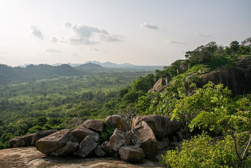
The Atakora mountain range forms the backbone of northwestern Benin. This modest massif—with peaks rising around 600 to 800 metres—stretches from Ghana through Togo into Benin, structuring a region where major wildlife parks, UNESCO-listed villages of vernacular architecture, and waterfalls intersect. It is one of the rare territories in West Africa where savanna fauna still survives in significant numbers.
Why visit Atakora
Three main reasons warrant a detour to this region of northern Benin:
- The Pendjari National Park, a UNESCO biosphere reserve, which harbours one of the last viable populations of elephants and large carnivores in West Africa.
- The Koutammakou, cultural landscape of the Tata Somba (Betammaribé), inscribed as a UNESCO World Heritage site since 2004 for its earthen architecture.
- A more temperate climate than the south of the country and contrasting landscapes—wooded savannas, cliffs, enclosed valleys—conducive to hiking and safari.
What to see and do
Pendjari National Park
Spanning over 2,700 km² at the edge of the massif, the park is part of the transnational WAP (W-Arly-Pendjari) complex. Elephants, buffalo, hippopotamuses, antelope species (waterbuck, roan antelope, hartebeest), baboons, and—with luck—lions and leopards, whose populations remain fragile, can be observed here. There are no rhinoceroses in West Africa: the "big five" formula does not apply here. Birdlife is rich, particularly at watering holes during the dry season.
The transnational W Park
Shared between Benin, Niger and Burkina Faso, this UNESCO-listed park complements the region's wildlife offerings. It extends Pendjari's territory to the northeast and harbours comparable fauna, with lower tourism pressure.
Somba country and the Tata
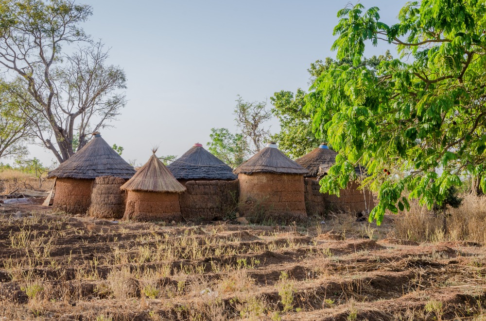
The Betammaribé, commonly called Somba, live in fortified houses built of rammed earth, wood and thatch, adorned with geometric motifs and crowned with turrets that once served as granaries and watchtowers. The cultural landscape of Koutammakou, which straddles the Togolese border, is inscribed as a World Heritage site. Visits are conducted with a local guide, who deciphers the symbolism of spaces and rituals.
The Fulani
Nomadic herders, the Bororo Fulani roam the region with their herds. Their seasonal encampments and livestock markets punctuate the territory, particularly around Natitingou and Tanguiéta.
Tanougou Falls
At the gateway to Pendjari, these cascades of approximately 20 metres drop into a basin suitable for swimming. The easily accessible site constitutes a classic stop before or after a safari.
The Dassa Caves
Further south, on the route between Cotonou and Atakora, the Dassa-Zoumé caves served as refuge for local populations during inter-kingdom conflicts. They retain a memorial and spiritual dimension for residents.
A touch of history
The Atakora range results from a Precambrian geological formation, distinct from Niger's Aïr massif. The relief long served as a refuge zone: Somba populations settled here to escape slave raids from coastal kingdoms and northern cavalry, explaining the defensive function of their Tata. Northern Benin remained apart from the great southern royal centres (Abomey, Porto-Novo) and preserved vibrant animist traditions, parallel to the voodoo worship practised further south.
When to go
The climate is tropical with two distinct seasons:
- Dry season (November to April): recommended period for safaris. Vegetation becomes sparse, animals concentrate around water sources and visibility is optimal. December to February offers the most bearable temperatures; March-April marks peak heat with the harmattan winds.
- Rainy season (May to October): tracks sometimes impassable, Pendjari park often closed from approximately June to November. Vegetation is dense, animals dispersed.
Practical information
- Accommodation: lodges and campsites near Pendjari (Tanguiéta, Batia), hotels in Natitingou, community guesthouses in Somba villages.
- Guide: mandatory at park entrances and strongly recommended for cultural visits.
- Health: malaria zone, prophylaxis essential. Yellow fever vaccination required upon entry to Benin.
- Safety: the situation in northern Benin is evolving. Consult your country's official foreign affairs ministry recommendations before departure.
How to get there
International arrival is in Cotonou, on the coast. From there, allow approximately 10 to 12 hours of driving to reach Natitingou, the regional capital and gateway to Atakora. Options include: scheduled buses (local companies), private vehicle with driver, or domestic flight if the link to Parakou or Natitingou is operational. From Natitingou, tracks lead to Tanguiéta, Pendjari and Somba country.
To see in the region
A trip to Benin typically combines north and south. Before or after Atakora, several sites deserve a detour:
- The Route of Slaves at Ouidah, a major historical memorial.
- The Kpassè Zoun sacred forest, a major voodoo site.
- The Grand Mosque of Porto-Novo, a former voodoo temple converted.
- Birdwatching in the southern wetlands.
Frequently asked questions
Frequently asked questions
Prepare your trip
To incorporate Atakora into a complete itinerary, explore our tailor-made trips to Benin, which combine the mountainous north and cultural south.
Nearby
Interested in this visit?
We can include it in your personalised itinerary.