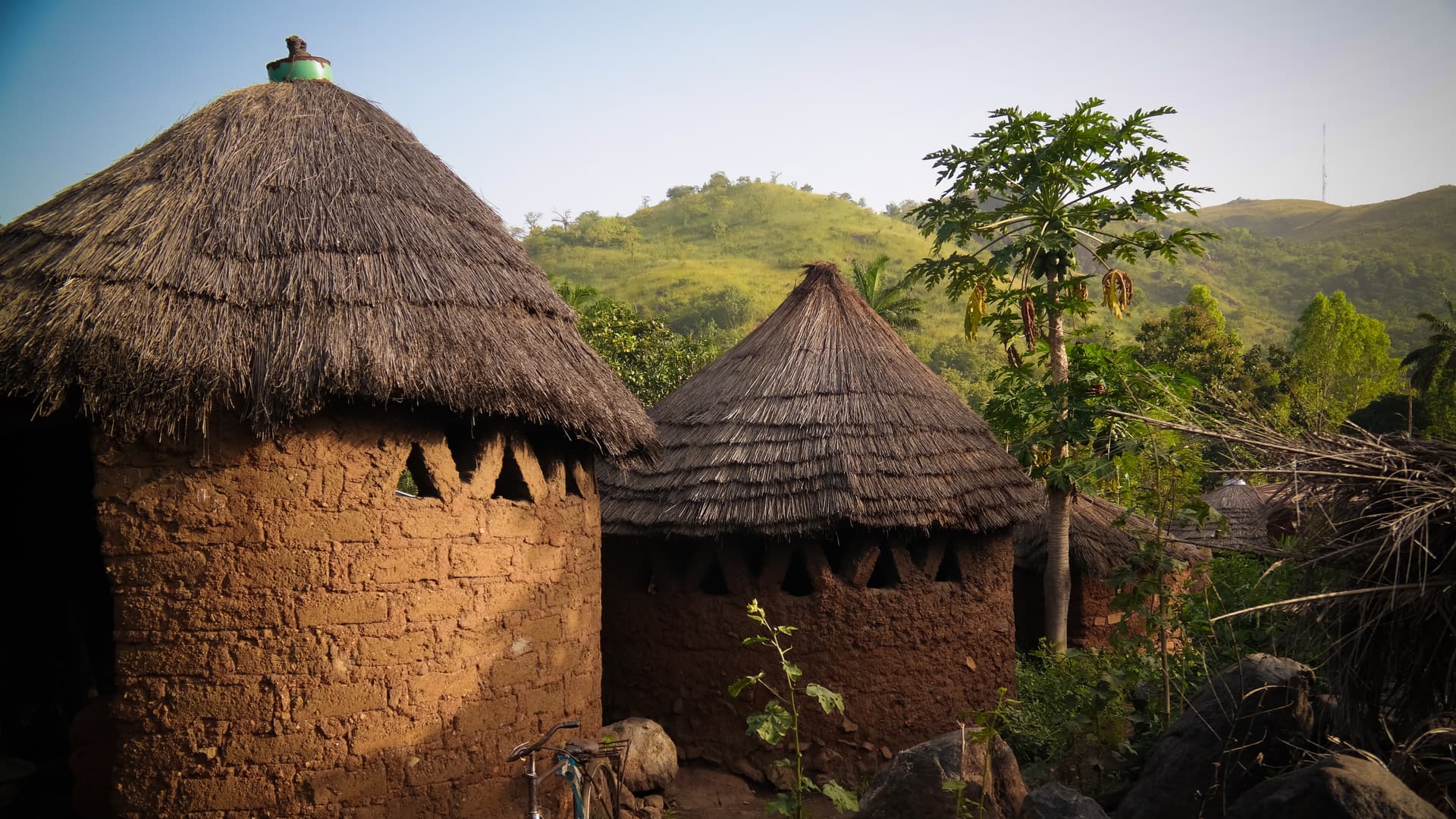
Kara Region
Birthplace of the Kabyé people, Kara showcases perched villages, terraced mountain cultivation and initiatory Evala wrestling each July.
The Kara region spans approximately 11,700 km² in northern Togo, 420 km from Lomé via the national highway. Here, around the city of Kara (the regional capital, with roughly 110,000 inhabitants), lives the Kabyé people, the country's second-largest ethnic group after the Ewé. The landscape shifts markedly from the south: wooded savanna replaces humid forest, and the Kabyé massifs rise around 800 meters, shaping the terrain into cultivated terraces whose geometric precision strikes visitors arriving from the plains below.
The perched villages of Pya, Sarakawa, Landa and Lama-Kara form the heart of Kabyé country. On these rocky hillsides, farmers have for generations cultivated millet, fonio, sorghum and yam, constructing dry stone walls that hold the soil in place. This hillside agriculture forged the Kabyé people's reputation for resilience, and blacksmiths still work iron in several hamlets. At Bohou and Kouméa, you can observe workshops where hoes and machete blades are forged, accompanied by the sound of goatskin bellows.
The region is renowned for the Evala, initiatory wrestling matches held each year in July over two weeks. Young Kabyé men aged 18 to 22 compete bare-chested, dusted with flour, in the earthen arenas of each canton. This is not a spectacle staged for tourists: it is a rite of passage that structures the social calendar, followed by the Akpéma (initiation of young women) in August. Witnessing the Evala requires precise planning around these dates, which are published annually by the chieftaincy.
On the landscape front, the Atakora chain begins west of Kara, toward Kétao and the Benin border, and foreshadows Tamberma country with its sandstone massifs and deep valleys. To the southeast, the Yadè waterfall and the banks of the Kara River offer swimming possibilities during the dry season. Local cuisine centers on millet paste accompanied by glutinous sauces of okra or baobab leaves, and tchoukoutou, millet beer served in gourds at the weekly markets of Kétao (Wednesdays) and Pya.
The climate is Sudanian in type, marked by a long dry season from November to April and a rainy season concentrated from June to September. In December and January, the harmattan—a dry wind from the Sahara—shrouds the horizon in dust haze and causes nighttime temperatures to drop around 16 °C, while afternoons reach 33 °C. This temperature range can surprise, and explains why we recommend bringing a light fleece even during the height of the dry season.
The region lends itself to village hiking over two to four days, in short loops between Kabyé hamlets, with nights spent with local families or in basic encampments. It also serves as a logical transit point to Tamberma country to the northwest, or to the Savanna region further north. Our team works here with a network of local guides fluent in Kabyè and Tem, essential for entering villages with proper greetings.
Must-See
Agricultural terraces of the Kabyé mountains. A 3 to 5-hour walk between Landa-Pozanda and Farendé, along switchback trails bordered by dry stone walls and fonio fields. Clear views over the Oti plain in good weather.
Evala wrestling in July. Two weeks of initiatory bouts in the arenas of the cantons of Pya, Lama and Tcharé. Exact dates are set each year by the Kabyé chieftaincy, usually in the first half of July.
Traditional forge at Bohou. Visit workshops where blacksmiths smelt local iron ore and shape hoes and blades by hammer. Work begins before 6 a.m. to avoid midday heat.
Kétao market on Wednesdays. The region's largest market, 25 km from Kara near the Benin border. You'll encounter Fulani herders, Kabyé farmers and Hausa traders around stalls of millet, yam, textiles and tchoukoutou.
Yadè waterfall and pools. Natural site 30 km southeast of Kara, accessible by track. Swimming possible from October to February, when water flow is moderate and the water is clear.
When to Visit
The best time to visit Kara stretches from November to February, with dry days around 30 to 33 °C and cool nights (16 to 20 °C). December and January are marked by the harmattan: visibility drops, the sky becomes hazy, but temperatures remain pleasant for hiking. March to May concentrate the heat, with peaks at 38 °C in April and a heavy atmosphere that makes midday hikes uncomfortable.
The rainy season runs from June to September, with a peak in August (around 250 mm for the month). Secondary tracks to perched villages become muddy and some become impassable by 4x4. Conversely, this is when the landscape is at its greenest and crops are in full growth. July remains an exception: despite the rains, it is the month of Evala, and most travelers targeting this region plan around this event, accepting less comfortable travel conditions.
Practical Advice
We recommend allowing three to four days on the ground to fully grasp the region: one day for Kara and its immediate surroundings (Sarakawa, memorial, market), one to two days hiking in the Kabyé mountains with nights in villages, and one day for Kétao and Yadè waterfall. Access is via road from Lomé (7 to 8 hours' drive on the national highway, which is paved and in good condition) or by seasonal domestic flight to Niamtougou, 35 km north of Kara.
Kara combines naturally with Tamberma country (2 hours by track to the west, toward Nadoba) and with the Savanna region further north. For a coherent northern circuit, allow 8 to 10 days combining these three regions. Comfort remains modest: in Kara city, two or three hotels offer air conditioning and hot water, but in villages nights are spent in encampments or guest huts, with shared facilities. This region suits travelers curious about village encounters and accustomed to a slow pace, as well as moderate-level hikers. It is less suited to families with young children, due to distances and limited comfort.