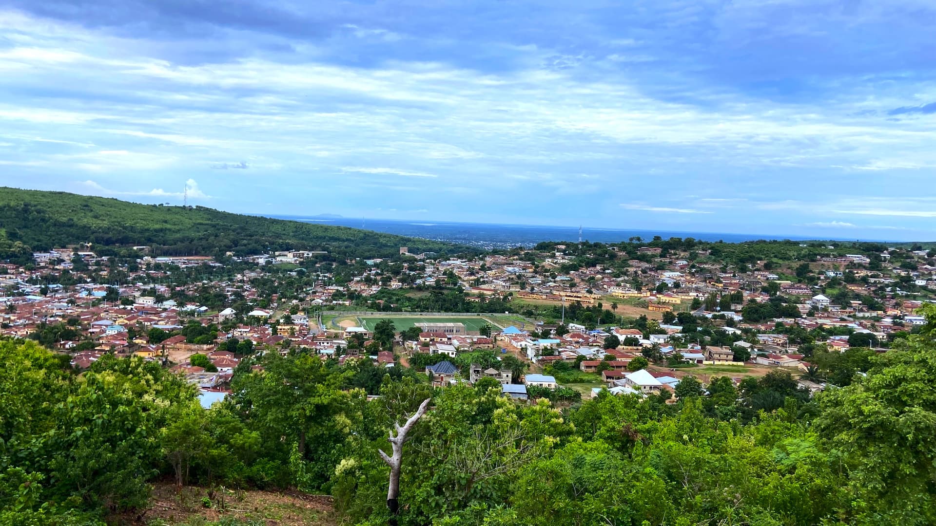
Central Region
Between Sokodé the Muslim city and Fazao-Malfakassa park, the Central Region marks Togo's hinge, where the Christian-animist south meets the Sahelian north.
The Central Region stretches from Blitta in the south to Aléhéridè in the north, traversed by national road 1 which connects Lomé to Dapaong. Two cities structure this territory: Atakpamé, tiered across hills at 400 meters altitude, and Sokodé, the country's second city, economic capital of the centre and stronghold of the Tem community. Between the two, the landscape alternates between granite plateaus, wooded savannas and forested massifs, with a few inselbergs rising above cassava, yam and cotton fields.
Sokodé embodies the region's cultural identity. The city is predominantly Muslim, marked by the presence of the Tem (or Kotokoli) people and punctuated by two major annual festivals. The Gadao-Adossa, celebrated in early January, opens the agricultural cycle and gives rise to the famous Adossa-Gadao fire dances, where initiates handle hot coals without burning themselves. Sokodé's markets, bustling three times a week, remain the best place to witness traditional weaving, indigo dyeing and kola nut trade with neighbouring Burkina Faso.
Atakpamé, capital of the Plateaus region but southern gateway to the Centre, preserves an urban layout inherited from the German and later French colonial periods. The city was once an important railway hub and remains a crossroads between the east, towards Benin via Badou, and the west, towards Ghana. Surrounding villages, notably those in the Ana-Ifè area, still practise vodun cults specific to the plateau.
The region's major natural attraction is Fazao-Malfakassa national park, 192,000 hectares of wooded savanna and gallery forests backed by the Atakora chain, which extends from Benin. Wildlife suffered from poaching in the 1990s, but more stable management has allowed for the survival of buffalo, Buffon's kob, hippotragus, baboons and a small population of elephants. The landscapes, dominated by the Malfakassa escarpments and the Mô valleys, are as rewarding as the wildlife itself. To the east, the Anié basin and the Mono river offer different, more agricultural horizons.
The climate marks a transition between the southern bi-modal pattern and the north's Sudanian climate: a single rainy season from May to October, followed by a distinct dry season from November to April, with the harmattan descending from the Sahel in December-January. This climatic shift is visible in the landscape, rooftops, crops and even local dishes. In Sokodé, people readily eat wagash (grilled Fulani cheese), yam paste and sauces made with baobab leaves, rarer in the south.
For our team, the Central Region is less a destination in itself than a necessary link between the coastal south and the north of Tamberma country. Spending two or three nights here allows you to understand how Togo articulates its identities, from the Christian-animist character of the coast to the Muslim Sahel, passing through this pivotal centre where both worlds meet.
Must-see
Fazao-Malfakassa national park. 192,000 hectares of wooded savanna between the Malfakassa escarpments and the Mô valley. Passable tracks during the dry season, sightings of buffalo, kob and baboons, and traces of elephants in the Boulohou sector.
Adossa-Gadao fire dances in Sokodé. Annual Tem ceremony in which initiates handle incandescent coals to the beat of tam-tams. It typically takes place in early January according to the local Islamic lunar calendar.
Sokodé central market. Indigo fabrics, kola nuts, gourds and cloths from Saharan caravans. On busy days (Monday and Friday), you'll encounter Hausa, Fulani and Burkinabè traders.
Aléhéridè hills and waterfalls. North of Sokodé, a series of cascades descending from the foothills of Kara. Accessible from July to November; dry the rest of the year.
Atakpamé and the Ana-Ifè plateau. City tiered across seven hills, former German colonial buildings and surrounding vodun villages where kente cloth is still hand-woven.
When to visit
The best period runs from November to February. Tracks in Fazao-Malfakassa park are passable, vegetation clears and wildlife observation becomes feasible. Temperatures remain pleasant, between 22 and 32°C during the day, with cool nights in Sokodé sometimes dropping to 18°C in December under the harmattan. From March to April, heat rises sharply, reaching 38-40°C, and dust fills the air. May marks the return of rains.
From May to October, the rainy season transforms the landscape: the savanna turns green again, the Aléhéridè falls regain their flow, but some park tracks become impassable, especially in August and September when rainfall reaches 200 mm per month. This period remains interesting for those interested in crops and agricultural landscapes, less so for wildlife.
Practical advice
Our team recommends a minimum of two to three nights in the Central Region: one in Sokodé for the city and its market, one or two near Fazao-Malfakassa park depending on whether you want a simple transit or genuine observation time. Access is exclusively by road, from Lomé (340 km, 5 to 6 hours to Sokodé) or from Kara (90 km to the north). There is no operational airport in the region.
The Central Region logically combines with Kara Region to the north and Tamberma country to extend further to the Tata Somba, or with Kloto Plateau and Lomé and the coast to the south. On a Lomé-Dapaong circuit, it's the pivotal stage in the middle of the journey. Hotel comfort remains simple, standard category hotels in Sokodé and Atakpamé, more rustic lodges on the Fazao border. The region suits travellers curious about living cultures and savanna landscapes, less so families with young children seeking swimming or structured activities.